Šibenik-Knin County map
canvas, see more


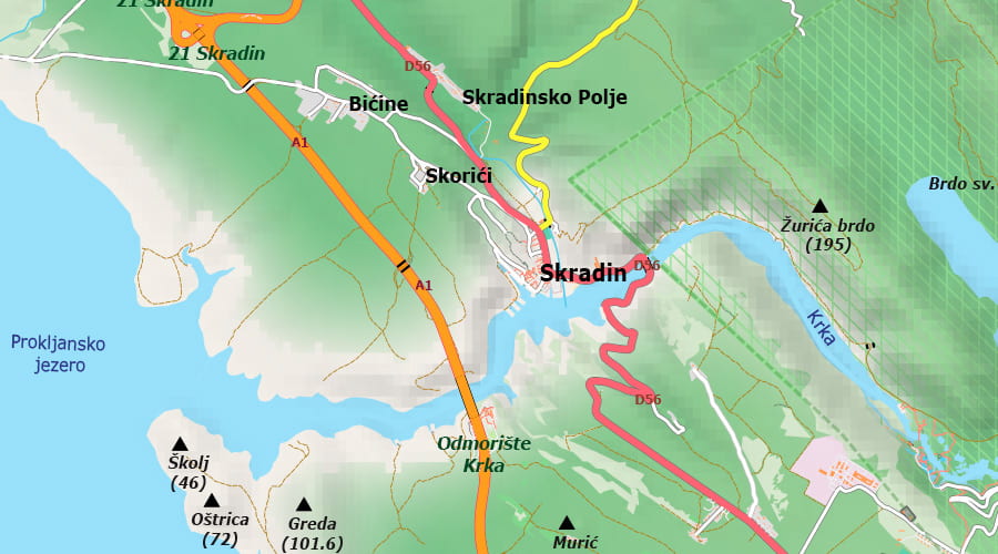
A very detailed map of Šibenik-Knin County. It shows all main and secondary roads and tertiary roads. The maps are all vector-drawn, you can set the map dimension yourself, there is no loss of quality (they are not images). If you want a clear map of the county for easy planning, then this is the map for you.
Šibenik-Knin County is a county in Croatia located in central and northern Dalmatia. In its current borders, it was established in 1997 and covers an area of 2994 km². The county is located on a karst surface, and in its Adriatic area, it includes a total of 285 islands and rocks. In addition to a very indented coastline, as well as numerous cultural and historical landmarks, the county is one of the highly developed tourist areas of Croatia. In addition to tourism, agriculture is also developed in the fertile karst fields, and in urban centers and entrepreneurial zones, industry. It is home to Croatia's highest peak, Dinara, at 1,831 m, as well as the Kornati and Krka national parks. In addition, the area of Šibenik-Knin County is also partially covered by two nature parks: Vrana Lake and Velebit.
Everybody should be able to enjoy their life, because you only live once. So I just want to get it all out there and be the best role model that I can be, if people want to put me in that kind of predicament. I mean, I didn't ask to be a role model, because I'm not perfect.
Don't lower your expectations to meet your performance. Raise your level of performance to meet your expectations. Expect the best of yourself, and then do what is necessary to make it a reality.